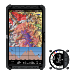
The successor to the smallest member of the LX80/90xx family is here. 2021 sees the birth of the next generation of small compact high end navigational instruments and the LX8030 is following the LX8040. It comes packed with a V8 variometer (optionally with V80). A 4.0″ anti-glare display that fits everywhere and an automatic light sensor that adjusts that brightness and optimizes the power consumption.
When compared to the LX8080 you find the following numbers: 31% bigger screen, 3 times more pixels and integrated WiFi-functionality.


LX8030
€3,837.50 Ex. Tax: €3,070.00
Available on back-order
Specification
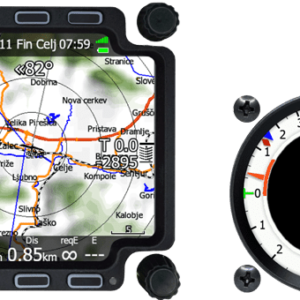
– Dimensions: height: 82 mm, width: 82 mm, depth: 77 mm, weight: 470 g.
– Display resolution: 480 x 480 pixels, Brightness: 1000 cd.
– High-level IGC approved flight recorder with advanced engine noise level sensor. With MOP and MOP2 devices also JET, Electro and FES approved.
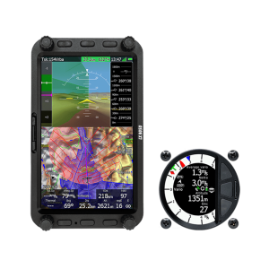
– Many statistics are available during and after the flight. Real time OLC scoring is available during the whole flight.
– Preloaded worldwide terrain, map, airspace and airport databases – FREE of charge!
– ICAO, IFOS, Rogersdata … buy and load your own ICAO maps.
– Airport mode navigates to a selected airport with all necessary information, such as RWY direction, length, frequency and type (grass/asphalt).
– Each page layout can be completely customized using LX Styler.
– Waypoint and Task Mode. Very easy selection of Waypoints with an intuitive user interface. Create a task on the device or in SeeYou and simply load it via the USB or Wi-Fi (WiFi is a standard feature) or SD (SD cardreader is optional).
– The AAT assistant shows the most optimized direction for maximum speed on the task. A very accurate time calculation helps you to arrive home precisely on time.
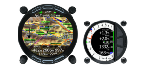
– The Flarm mode feature displays all types of FLARM objects if the optional, integrated PowerFlarm module is installed. ADS-B objects can also be displayed if the optional, integrated ADS-B receiver is installed. External PowerFlarms, Flarms and/or ADS-B receivers can also be connected.
– The Flarm Radar shows all necessary data. The target’s present position, altitude and vertical speed are displayed on the map. For each new alert a pop-up appears automatically when a potential collision occurs. The system will also trigger a sound and/or voice warning. (optional, integrated PowerFlarm module or connection with external PowerFlarm required)
– 56 channel GPS module built in and USB port available for data exchange and smartphone charge.
– SD card socket optional.
– GO-TO function without any waypoints by using the PAN mode. Simple and visual exploration of nearby airspaces with all details.
– 4 different methods are used to precisely calculate wind speed and direction. An inertial variometer provides a very accurate wind indication during straight flight.
– The wind altitude profile displays the wind indication at different altitudes. The wind arrow shows the current wind direction. The arrow can be customized in size, position and colour.
– Integrated Wi-Fi frees up you USB port and allows for more compact instrument installation…and of course this gives you many extra features:
– NOTAMs, flight uploads, GPSAeroData, US Charts, device upgrades and many other features are now just a click away even while flying.
– Don’t be worried while flying a long distance flight – now you can see a real time rain radar picture while in the air. Combine it with satellite image to ensures you stay one step ahead of the weather at all time.
– It’s like having a meteorologist on board with weather forecast services provided by TopMeteo and SkySight (subscription required). More than 20 different weather layers allow you to plan your flight to perfection.
– Download competition task on race-day from Soaring spot and send your day-winning flight log by email to competition director with just one push of the button.
– Uploading your flight to websites such as WeGlide has never been easier.
– Google drive and Dropbox support makes synchronizing waypoints, tasks, airspaces and pilot profiles fast and simple.